*By: Catherine Sugrue*
Hiking is one of my all-time favourite activities. It’s a great way to soak in all of the health benefits that nature has on offer, while also affording yourself an opportunity to experience some pretty spectacular things around every corner. Be it for the abundance of wildlife, or that feeling of finally getting to lookouts that span across beautiful lands, for the benefits of exercise and fresh air, or even for the company you bring along – you’re always in for a treat somewhere along the way…
It’s not often that people think about Toronto when they’re looking for places to explore nature and do a bit of hiking. But, I think you’d be surprised to learn that there are some really great trails, either pretty close to the big city or practically right in the middle of it. So whether you’re looking to hop right on to the TTC to get your nature on or you’re ready to drive about an hour or so for an adventure – I’ve rounded up some hiking trails around Toronto that you should absolutely check out. Here are my top 8:
The Best Hiking Trails In And Around Toronto
1. Scarborough Bluffs
Length Of Trail: 14 km
Time: 1 – 2 hours
Level: Easy to Moderate
How to Get There: Access to Bluffers Park at Brimley Road, with paid parking on site. Also accessible by TTC.
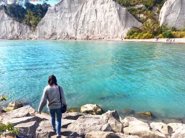
Located just east of downtown Toronto, the trailhead begins at Bluffers Park. Tracing the banks of Lake Ontario, this trail offers stunning views all year long of a hidden gem right along Toronto’s famed waterfront. Formed primarily by erosion of the packed clay soil and shaped into quite a stunning sight, at their highest, the bluffs rise 65 m above the water. On the trail itself, you’ll be led through the park, where there are picnic and rest areas, as well as some beautiful naturalized spaces in between.
2. High Park
Length Of Trail: 5.3 km
Time: 1 – 2 hours
Level: Easy to Moderate
How to Get There: Several points of access, with free parking on site. Accessible by TTC.
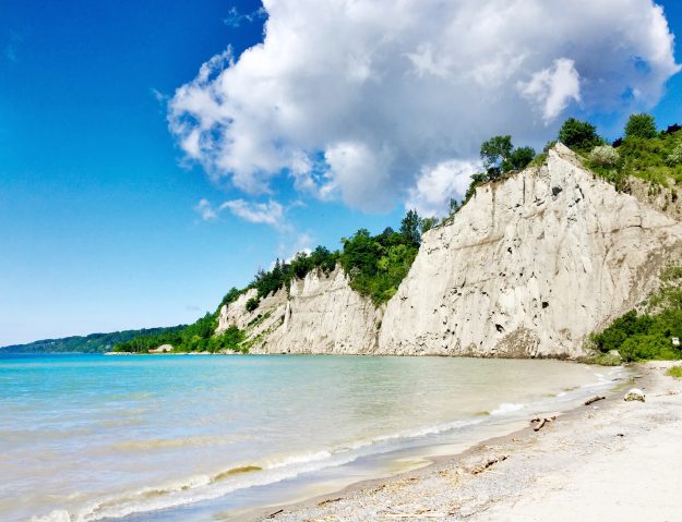
Known as Toronto’s largest public park at 161 hectares (399 acres), it features many hiking trails, a dog park, lakefront access, picnic areas, greenhouses, diverse vegetation, playgrounds, sports fields, a zoo, the beautifully landscaped Hillside Gardens, a few places to grab a quick bite to eat, and a lot of squirrels. They host events throughout the year and even have a hiking club that allows you to explore through guided walks. As close as it is to downtown Toronto, one third of the park still remains in a natural state, which means that wildlife is still flourishing there – including a few rare plant species. You can even check out the historic Colborne Lodge and the Coach House on site.
3. East Don Parkland
Length Of Trail: 4.8 km
Time: 2 – 3 hours
Level: Easy to Moderate
How to Get There: Parking on site located on Equestrian Court south of Steeles on
Leslie. Accessible by TTC.
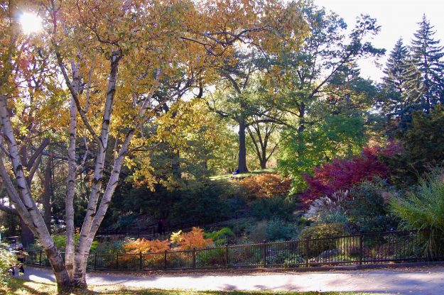
The Don River watershed spans about 32 kms from the Oak Ridges Moraine down to Lake Ontario. Along this beautiful area tucked away from the city traffic, you’ll discover wetlands, wildflowers, meadows and native species. Although there are lots of trails on site, none of them are end-to-end trails. Walk the Don does offer a series of self-guided walks located throughout the region itself. Following the Germain Mills Creek and East Don River, you’ll find the East Don Parkland trail which is a natural channel full of an abundance of wildlife. Be sure to look out for beavers, rabbits and waterfowl.
https://www.instagram.com/p/BsnfrzsBP4D/
4. Evergreen Brickworks
Length Of Trail: 2.4 km
Time: 1 hour
Level: Easy
How to Get There: Access through free shuttle bus, walking, biking and TTC. Parking on site.
If you’re looking for an easier trail with incredible views right in the middle of the city, look no further than Evergreen Brickworks. Although it can get a bit busy during the days when the market on site is open, it’s worth a climb up the hill in the back of the Brickworks in order to check out the sprawling city landscape. Primarily used for walking, bird-watching and nature trips, it’s accessible all year-round.
https://www.instagram.com/p/BvRVpxNAJD6/
5. Humber Trail
Length Of Trail: 8 km
Time: 4 – 5 hours
Level: Easy to Moderate
How to Get There: Start of trail at main intersections are Stegman’s Mill Road and Islington Avenue. Accessible by TTC with non-dedicated access to parking nearby.
The first phase of this trail is about 3.5 km with a link to the Canadian McMichael Art Collection and Boyd Conservation Area. Completely open and spanning across the city, it’s perfect for walking, hiking and biking. You’ll see many natural habitats, educational and recreational facilities, cultural and heritage resources, as well as the historic aboriginal trade route known as the Toronto Carrying-Place Trail. Due to these values and more, Humber River has been designated as a Canadian Heritage River.
https://www.instagram.com/p/Bt9CSErgbcu/
6. Rouge National Urban Park
Length Of Trail: Varying from 500m to 7.6 km
Time: Varying from 15 mins – 3 hours
Level: Varying from Easy to Difficult
How to Get There: Many points of entry for parking, with access from 401. You can also travel by Parkbus. Accessible by TTC.
With several trails on offer, this large area of Parks Canada wilderness isn’t too far from the big skyscrapers of downtown Toronto. Spanning over 47 kms, you’ll find the City’s biggest wetland where the Rouge River empties into Lake Ontario. Protecting two National Historic Sites and a variety of ecosystems joining the post-glacial Oak Ridges Moraine, there’s a rich diversity of natural, cultural and agricultural landscapes on offer. It’s also home to some of the last remaining working farms in the Greater Toronto Area, as well as Toronto’s only campground. You’ll also find traces of human history dating back over 10,000 years, including some of Canada’s oldest known Indigenous sites.
https://www.instagram.com/p/BqK8RnlBxsB/
7. Rattlesnake Point
Length Of Trail: 12 km
Time: 4 – 5 hours
Level: Moderate to Difficult
How to Get There: Access to parking on site. You can also travel by Parkbus.
Offering breathtaking views down to Lake Ontario, the trails near Milton line the top of the Niagara Escarpment. With lots to explore, the most popular and also the most challenging is a 7.2 km hike to Crawford Lake Conservation Area. Immerse yourself in the tranquil forest filled with thousand-year old cedars, towering cliffs with several viewpoints, and soaring turkey vultures above. If you’re into rock climbing, this is a great spot for you. There are also shorter trails that stick closer to Rattlesnake Point which offer quicker adventures for the time-conscious. It’s important to note that there is an admission fee to access the park itself.
https://www.instagram.com/p/BslxgHqjduL/
8. Bruce Trail
Length Of Trail: 800 km
Time: Varying lengths depending on trail
Level: Varying from Easy to Difficult
How to Get There: Over 300 access points with parking. Some accessible by TTC.
This is an absolutely massive trail system which stretches along the Niagara Escarpment with its closest access point to Toronto located just outside of Milton, near the Kelso Conservation Area. It’s Canada’s oldest and longest marked footpath from Niagara to Tobermory, with many featured hikes on offer for you to try, at all different levels. The scenery along each trail is lush and absolutely stunning, ranging from dense forests to sweeping lake views to rocky gorges – so you’re always spoiled for choice.
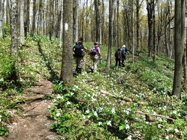
Photo c/o Toronto Bruce Trail Club.
What To Pack For Your Hike
Okay, so I’m not trying to be the fun police here – quite the opposite actually. But it should always be safety first, my friends. It’s important to make sure that you pack a few things for your adventure into the wilderness, even if it is so close to civilization. Obviously, there are tons of different items that you can take along with you, but here’s a simple list of some basics for a day hike, in order to help you to make the most of your epic journey:
Water Bottle: Be sure to stay hydrated! Ideally, you’ll also help mama nature out by snagging a reusable one. You can even take it a step further by getting something like a LifeStraw, in case you’re ever stuck and in need of a quick drink.
First Aid: Whether you throw a few things together by having some bandaids, alcohol wipes and bandages on hand, or you have a ready-made kit – this is always a good option just in case something happens. This might also include a multi-tool, some rope or even small blankets.
Snacks: Although you might only be gone for a short period of time on some of these treks, it’s important to make sure that you’re staying on top of fuelling your body properly with healthy eats during that physical activity.
Practical Clothing & Footwear: Yeah I know, it may not be the cutest thing in the world to think about while you’re snapping that iconic Instagram photo, but you’ve just gotta dress appropriately for the weather conditions and also for the level of hike you’re about to partake in. Layering up is key! And you should think about also packing a hat for either that hot or cool weather – to keep your head warm or to help prevent heatstroke.
Phone / Map / GPS: Remember to stay on marked trails at all time. No matter where you’re exploring, as soon as you get out into nature, people should know where you are – including yourself. If you’re going solo, be sure to let someone know that you’re headed out into the wilderness and then check in with them upon your return. If you’re out exploring with others, make sure that you all know the way back to a safe location at any point on your journey, just in case!
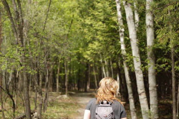
“Of all the paths you take in life, make sure a few of them are dirt.” – John Muir
Want more inspo? Click Here For Scenic Toronto Walks



1 Comment
Tom Worsley
July 4, 2019 at 5:49 pmThese are some of the best hiking trails Ontario has to offer. If your interested I have visited some of these trails and I have posted video and pictures at OntarioHikingTrails.net